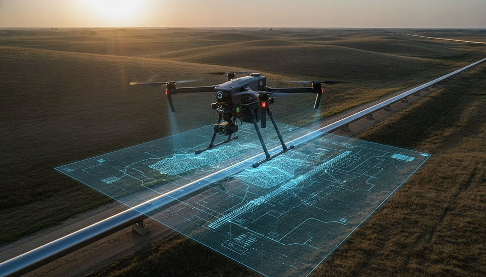
Photogrammetry Drone Inspection and Aerial Survey
- Dan

- May 28
- 4 min read
Photogrammetry is a powerful technique that transforms ordinary photographs into detailed, measurable 3D models. This method has reshaped fields like archaeology, construction, and even entertainment by providing accurate spatial data without the need for expensive or complex equipment. Understanding photogrammetry for drone inspections and aerial surveys opens the door to more than just visuals—they can unlock unprecedented photogrammetry-drone-inspection-aerial-surveyprecision, infinite grid alignment capabilities superior to traditional surveying and spatial insights in a fraction of the time.

How Photogrammetry Works
At its core, photogrammetry uses multiple photographs taken from different angles to reconstruct the shape and position of objects in three dimensions. The process involves several key steps:
Image Capture
Photographs are taken with overlapping views of the subject. The more overlap, the better the software can match points between images.
Feature Detection
Software identifies common points or features in the overlapping photos. These points serve as anchors for building the 3D model.
Matching and Triangulation
By comparing the position of these features across images, the software calculates their exact location in 3D space using triangulation.
Model Construction
The collected 3D points form a dense point cloud, which is then converted into a mesh representing the surface geometry.
Texturing
Finally, the original images are used to apply realistic textures to the 3D model, enhancing visual accuracy.
This workflow allows users to create precise models from simple photographs, making photogrammetry accessible and versatile.
Types of Drone Photogrammetry
Photogrammetry can be categorized based on the platform used for image capture and the scale of the project:
Aerial Photogrammetry and Drone Inspection Survey
This type uses images taken from aircraft or drones flying over large areas. It is common in:
Mapping landscapes
Monitoring environmental changes
Surveying construction sites
Aerial photogrammetry covers wide areas quickly and provides data for topographic maps or 3D terrain models.
Terrestrial Drone Photogrammetry & Aerial Survey
Images are captured from ground level, often using handheld cameras or tripods. This method suits:
Documenting building facades
Archaeological site recording
Industrial inspections
Terrestrial photogrammetry offers high detail for smaller areas or objects.
Close-Range Photogrammetry
Focused on small objects or detailed parts, close-range photogrammetry uses macro lenses or specialized setups. Applications include:
Cultural heritage preservation of artifacts
Quality control in manufacturing
Forensic analysis
This type provides fine detail and accuracy for objects that require close inspection.
Modern Applications of Aerial Survey
Photogrammetry has evolved beyond traditional surveying and mapping. Its modern uses span many industries:
Architecture, Construction, & Inspections
Architects and engineers use photogrammetry to create accurate 3D models of buildings and sites. This helps with:
Planning renovations
Monitoring construction progress
Detecting structural issues early
For example, a construction company might use drone photogrammetry to track changes on a large site weekly, saving time and reducing errors compared to manual surveys.
Archaeology and Cultural Heritage
Photogrammetry allows archaeologists to document sites and artifacts in detail without physical contact. This preserves fragile objects and creates digital archives. A famous case is the 3D reconstruction of ancient ruins, enabling virtual tours and research without risking damage.
Film and Video Games
In entertainment, photogrammetry creates realistic 3D assets from real-world objects. Game developers scan environments and props to build immersive worlds. Movies use it for visual effects, blending real and digital elements seamlessly.
Agriculture and Environmental Monitoring
Farmers and environmental scientists use aerial photogrammetry to assess crop health, monitor deforestation, and manage natural resources. Drones capture data that helps optimize irrigation and detect pest infestations early.
Forensics and Accident Reconstruction
Law enforcement agencies apply photogrammetry to recreate accident scenes or crime sites. Accurate 3D models help investigators analyze evidence and present clear visuals in court.

Benefits and Challenges
Photogrammetry offers several advantages:
Cost-effective compared to laser scanning
Non-invasive and safe for delicate subjects
Flexible for various scales and environments
However, it also faces challenges:
Requires good lighting and image quality
Complex surfaces or reflective materials can cause errors
Processing large datasets can demand considerable resources
Despite these challenges, advances in software and hardware continue to improve photogrammetry’s accuracy and ease of use.
Factors Contributing to High-Quality Photogrammetry
Image Quality
High-resolution images with good lighting and minimal distortion are essential. Clear images capture more detail, which improves the accuracy of the 3D model.
Camera Calibration & Technology
Proper calibration & type of the camera ensures that lens distortion is accounted for, which is crucial for accurate measurements and model reconstruction. Mechanical shutters provide a superior image quality without the need for image corrections.
Overlap and Coverage
Ensuring sufficient overlap between images (typically 60-80%) helps in accurate feature matching and reconstruction of the scene.
Ground Control Points (GCPs)
Using GCPs improves georeferencing and overall accuracy of the photogrammetric model, especially in large-scale projects.
Software and Processing Techniques
Utilizing advanced photogrammetry software with robust algorithms for feature detection, matching, and 3D reconstruction enhances the quality of the output.
Scene Complexity
The complexity of the scene can affect the quality; simpler scenes may yield better results than highly intricate ones with many overlapping features.
Post-Processing
Post-processing techniques, including filtering, mesh refinement, and texture mapping, can significantly improve the final quality of the 3D model.
Expertise and Experience
The skill and experience of the operator in capturing images and processing data play a crucial role in achieving high-quality results.