The Ultimate Wind Turbine Inspection Guide for Efficiency
- Dan

- 21 hours ago
- 8 min read
Surface erosion, cracks, or contamination on turbine blades can reduce power generation efficiency by 5% to 20%, representing a critical loss in annual energy production. You've likely observed that traditional rope-access inspections, which often require 3 to 6 hours per asset, create significant downtime and introduce unnecessary safety risks. This wind turbine inspection guide provides a technical roadmap for deploying advanced geospatial solutions to mitigate these inefficiencies. It's clear that legacy data silos prevent long-term health tracking, but autonomous technology offers a path toward comprehensive oversight.
We'll outline how the integration of LiDAR data collection and autonomous UAV systems facilitates a transition from reactive maintenance to a precise, predictive model. By leveraging AI-driven analytics and high-resolution digital twins, operators can align with the new Wind Turbine System Safety Rules launched in March 2026. This article explores the protocols required to achieve a 30% to 50% reduction in unscheduled component failures through standardized aerial oversight and high-fidelity data analysis.
Key Takeaways
Implement a systematic multi-stage protocol encompassing structural, electrical, and aerodynamic assessments to ensure total asset integrity and operational longevity.
Utilize this wind turbine inspection guide to distinguish between surface-level visual photogrammetry and structural-level LiDAR point cloud density for specialized data acquisition.
Execute high-fidelity aerial data collection using automated flight pathing that maintains a critical safety clearance of 15 ft to 30 ft from the rotor sweep.
Integrate AI-driven analytics and infrastructure digital twins to transform raw point clouds into actionable intelligence and track asset degradation over a 10-year horizon.
Wind Turbine Asset Integrity: The Critical Necessity of Systematic Inspection
Asset integrity management within the renewable sector necessitates a multi-stage protocol that transcends basic visual checks. Systematic inspection integrates structural, electrical, and aerodynamic assessments to ensure the long-term viability of wind turbine technology. This wind turbine inspection guide emphasizes that operational efficiency is directly tethered to meticulous data acquisition. Failure to identify minor defects early results in catastrophic component failure. A single day of lost production often costs thousands in revenue, making proactive oversight a financial imperative for modern energy portfolios.
Summary
This guide establishes a standardized framework for utilizing advanced geospatial data to transition from reactive maintenance to a predictive asset management model. The objective is to maximize operational uptime through high-resolution structural and aerodynamic analysis.
Technical Data Lifecycle
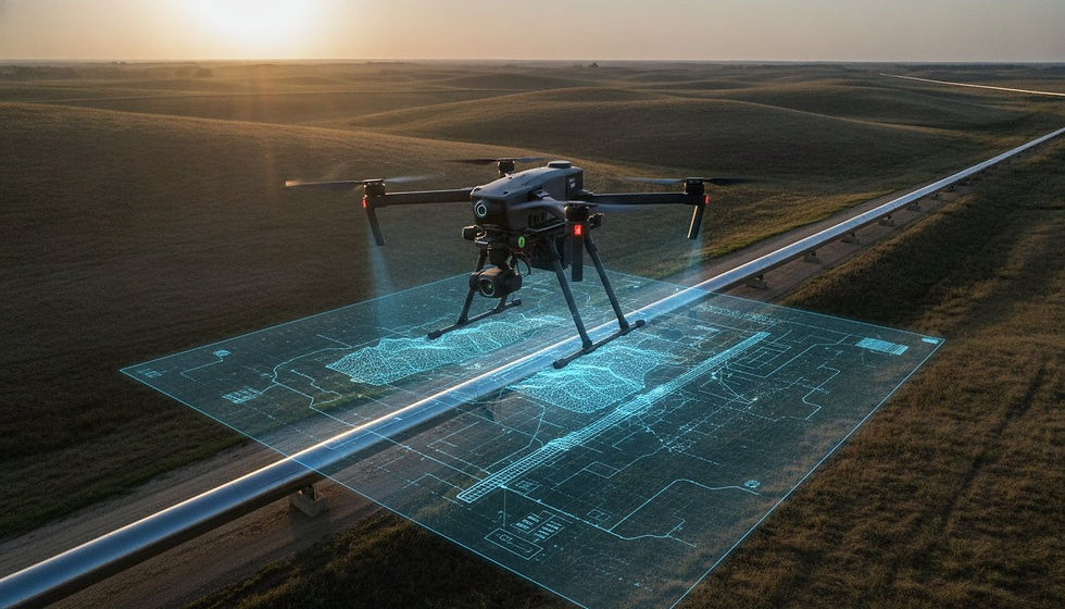
A conceptual flow diagram illustrates the data lifecycle: starting with autonomous UAV sensors capturing high-density LiDAR and thermal imagery, moving through cloud-based processing for automated defect recognition, and culminating in an AI-driven dashboard that provides real-time health metrics and digital twin updates.

Critical Components Subject to Degradation
Blade leading-edge erosion is a primary driver of aerodynamic efficiency loss. Even microscopic surface disruptions can significantly alter the lift-to-drag ratio, reducing output. Structural integrity analysis must also encompass the nacelle and tower, specifically monitoring bolt tension and weld fatigue. Foundation monitoring remains vital, especially in varied US soil conditions where settling or erosion can compromise the entire vertical structure. Sensors must detect shifts as small as 1 in to prevent lean-induced stress.
Lifecycle Inspection Milestones
Asset health tracking begins with commissioning audits to establish a baseline digital twin. This initial data set is essential for identifying manufacturing defects during end-of-warranty (EOW) inspections. Post-extreme-weather assessments are equally critical. Following high-wind events or lightning strikes, immediate aerial oversight identifies subsurface delamination that traditional methods miss. Regular intervals ensure that minor anomalies don't evolve into total system failures, protecting the long-term capital investment of the farm.
Advanced Data Acquisition Methodologies: LiDAR vs. Visual Photogrammetry
High-fidelity data acquisition within a modern wind turbine inspection guide requires a strategic distinction between surface-level photogrammetry and structural-level LiDAR. While high-resolution photogrammetry provides exceptional visual detail for identifying surface cracks or paint degradation, it lacks the geometric precision necessary for structural deformation analysis. LiDAR sensors function as active remote sensing systems, emitting laser pulses that penetrate visual noise to map the exact coordinates of an asset. This capability allows for the measurement of blade sag and tower verticality with precision down to 1 in, providing a definitive assessment of structural health that visual sensors cannot replicate.
The utility of LiDAR extends to operational environments where traditional visual sensors fail. Because LiDAR does not rely on ambient light, it remains effective in low-light or high-contrast scenarios, such as inspecting the shadowed underside of a rotor or the interior of a nacelle. Integrating thermal imaging into the payload further enhances diagnostic depth. Thermal sensors detect subsurface delamination by monitoring differential cooling rates within composite materials and identify internal friction in the gearbox by mapping heat dissipation patterns. This multi-layered approach ensures that both external facades and internal mechanical states are fully documented.
LiDAR Point Cloud Analysis for Structural Modeling
The conversion of raw laser returns into a high-density 3D structural model is the foundation of advanced asset management. This process enables the identification of minute deviations in blade pitch and rotor balance that suggest internal structural fatigue. By establishing a precise geometric baseline, engineers can track subtle deformations over time, facilitating a move toward predictive maintenance. Organizations looking to optimize their data fidelity often utilize specialized LiDAR Data Collection and Analysis to ensure the accuracy of these 3D models.
Multi-Sensor Payload Integration
Deploying a multi-sensor payload—combining RGB, thermal, and LiDAR—eliminates the data gaps inherent in single-sensor workflows. This fusion allows for the simultaneous capture of visual evidence and structural data, providing a comprehensive overview of the turbine's condition. Correlating a thermal heat signature with a high-resolution visual image allows technicians to localize defects with absolute certainty. This integrated methodology provides the technical clarity required for complex nacelle inspections and long-term infrastructure digital twins.
Operational Execution: A Protocol for High-Fidelity Aerial Data Collection
Operational execution requires a rigorous pre-flight phase to ensure data integrity and personnel safety. Airspace authorization must be secured via LAANC or relevant regulatory channels prior to deployment. Weather-window optimization is equally critical; high-fidelity data capture necessitates wind speeds below 22 mph and specific solar positioning to minimize glare on composite surfaces. This wind turbine inspection guide mandates the use of automated flight pathing to maintain a consistent standoff distance between 15 ft and 30 ft. This precision ensures uniform pixel density across all captured surfaces, which is essential for accurate defect measurement.
Autonomous UAV systems provide an objective safety advantage by eliminating high-risk rope-access maneuvers. Beyond safety, these systems offer superior data repeatability. Sensor calibration is a non-negotiable requirement to ensure that data remains comparable across multi-year inspection cycles. Precise calibration allows for the longitudinal tracking of degradation, transforming isolated snapshots into a comprehensive historical record of asset health. This systematic approach reduces the variance inherent in manual inspections.
Standardized Flight Patterns for Wind Assets
Standardized flight patterns ensure 360-degree coverage of the rotor sweep and tower structure. Vertical tower scanning protocols utilize high-resolution imaging to detect hairline cracks and corrosion at the base and mid-sections. Blade-tip-to-root orbital paths provide comprehensive imaging of both leading and trailing edges. These predefined trajectories capture the entire aerodynamic profile, ensuring that no section of the blade remains unexamined during the flight sequence.
Data Quality Assurance and Control (QA/QC)
Quality control occurs in real-time during the mission. Telemetry monitoring ensures 100% overlap in photogrammetric captures, which is vital for high-accuracy 3D reconstruction. On-site data verification prevents the logistical burden of re-flights in remote wind farm locations. Professional Drone Mapping and Photogrammetry Services utilize these rigorous protocols to ensure that every flight yields actionable intelligence for maintenance teams. This level of oversight guarantees that the final data set is both complete and technically sound.
AI-Driven Analytics: Transforming Point Clouds into Actionable Intelligence
The final phase of a sophisticated wind turbine inspection guide involves the conversion of raw sensor data into high-level infrastructure intelligence. Automated defect recognition (ADR) utilizes machine learning algorithms to scan thousands of high-resolution images and LiDAR returns, identifying anomalies such as hairline cracks, oil leaks, and lightning strike exit points with surgical precision. This automated processing eliminates human error and drastically reduces data turnaround times. By integrating these findings into AI-driven geospatial analytics, operators can synchronize aerial data with enterprise asset management systems for a unified view of fleet health.
Central to this analytical framework is the creation of a high-fidelity infrastructure digital twin. These models serve as a persistent record, allowing for the tracking of asset degradation over a 10-year horizon. Unlike static reports, digital twins are dynamic datasets that evolve with each subsequent inspection. This longitudinal oversight is critical for maintaining structural stability and aerodynamic efficiency across the entire lifecycle of the turbine. It's the only way to ensure that historical data remains accessible and actionable for long-term planning.
Predictive Maintenance via Digital Twinning
Predictive maintenance relies on historical data comparisons to forecast component failure before it occurs. AI models quantify erosion rates on blade surfaces, specifically analyzing how leading-edge degradation impacts power curves. This quantitative approach allows managers to prioritize repair schedules based on actual performance loss rather than arbitrary time intervals. It's an evolution from reactive fixes to strategic intervention, ensuring that maintenance capital is deployed where it generates the highest return on investment.
Strategic Reporting for Executive Decision-Making
Raw point clouds and thermal maps are translated into simplified risk-assessment heatmaps for executive oversight. These visualizations distill complex technical data into actionable insights, highlighting critical vulnerabilities that require immediate attention. This standardized reporting provides an auditable trail for warranty claims and insurance compliance, ensuring that all maintenance activities meet rigorous industry standards. High-resolution digital twins for all turbine assets provide the transparency required for high-stakes industrial decision-making and comprehensive asset oversight.
Optimizing Renewable Infrastructure through Data-Centric Oversight
The transition from manual rope-access methods to autonomous geospatial intelligence represents a fundamental shift in renewable asset management. This wind turbine inspection guide has detailed the necessity of multi-sensor payloads and high-density LiDAR to move beyond superficial visual observations. By establishing a 10-year digital twin horizon, operators can effectively mitigate the 5% to 20% efficiency losses caused by blade erosion. The integration of AI-driven analytics ensures that raw data transforms into actionable intelligence; prioritizing repairs based on actual structural degradation rather than arbitrary schedules.
Maintaining national-scale infrastructure requires a partner capable of delivering high-fidelity results across complex data environments. Precision in data acquisition isn't just a technical requirement; it's a financial strategy to protect high-stakes energy investments. Consult with DroneWorksIQ for Enterprise Aerial Intelligence Solutions to leverage specialized LiDAR data collection and analysis alongside strategic AI-driven geospatial insights. Our national-scale infrastructure inspection expertise provides the technical depth required to ensure your assets operate at peak capacity. Secure the longevity of your fleet with methodical accuracy and advanced autonomous oversight.
Frequently Asked Questions
How often should wind turbines undergo comprehensive aerial inspections?
Most asset managers schedule visual blade inspections annually as a baseline requirement to maintain structural integrity. According to IEC 61400-24 standards, Lightning Protection Systems require a full electrical inspection every two years for Level I and II systems, while Level III and IV systems follow a four-year cycle. Adopting a condition-based approach through a wind turbine inspection guide allows for more frequent, semi-annual drone deployments to reduce unscheduled failures by 30% to 50%.
What is the primary difference between LiDAR and photogrammetry for wind turbine blades?
Photogrammetry utilizes high-resolution RGB imagery to identify surface-level defects like paint degradation or leading-edge erosion. In contrast, LiDAR generates high-density 3D point clouds to assess structural integrity. LiDAR is superior for measuring geometric deviations, such as blade sag or tower verticality, with precision down to 1 in. Combining both sensors provides a comprehensive overview of both the facade and the internal structural state.
Can drones inspect wind turbines while they are operational?
High-fidelity data collection generally requires the turbine to be parked and the blades feathered in a specific orientation. This state ensures sensor stability and allows the UAV to execute precise automated flight paths for 360-degree coverage. While some visual-only scans occur during slow rotation, structural analysis and thermal imaging for gearbox friction require stationary assets to ensure data repeatability and sub-inch accuracy.
What are the safety requirements for drone-based wind farm inspections?
Commercial drone pilots must hold a Part 107 license as the legal minimum in the United States. Additionally, industrial wind farm environments frequently mandate OSHA safety certifications or Global Wind Organization (GWO) Basic Safety Training. Operational protocols require maintaining a safe standoff distance of 15 ft to 30 ft from all components to prevent collisions and ensure uniform sensor resolution across the captured dataset.
How does AI improve the accuracy of wind turbine defect detection?
AI improves accuracy through automated defect recognition (ADR) algorithms that process massive datasets with consistent precision. These systems identify microscopic anomalies like lightning strike exit points or oil leaks that human reviewers might overlook during manual analysis. By integrating this intelligence into a wind turbine inspection guide, operators can create infrastructure digital twins that track asset degradation over 10-year periods with auditable accuracy.