Total Station vs RTK/PPK Drone Imagery: Which Is Better?
- Dan

- 3 days ago
- 8 min read
Updated: 2 days ago
What if the millimeter fidelity of a Total Station is currently the primary bottleneck in your infrastructure lifecycle? While traditional surveying remains the benchmark for point-specific precision, the demand for rapid, comprehensive spatial intelligence necessitates a shift toward autonomous systems. Most technical decision-makers agree that the slow turnaround of manual methods and the high cost of ground control point placement are no longer sustainable for large-scale projects. This authoritative comparison of Total Station vs RTK/PPK Drone Imagery evaluates the trade-offs between 0.04 in point accuracy and the dense, multi-million point datasets generated by modern UAV platforms.
You will gain a clear understanding of the accuracy thresholds required for engineering-grade deliverables and a methodical framework to select between RTK and PPK workflows. The discussion explores how to maintain 0.4 in to 1.2 in absolute accuracy while leveraging AI-driven geospatial insights to transform raw data into strategic assets. We conclude with a strategy for integrating these advanced sensors into a unified digital twin environment to maximize operational efficiency and data reliability.

Comparative Analysis of Geospatial Data Acquisition Methodologies
The evolution of geospatial intelligence is defined by the transition from discrete, manual point sampling to comprehensive, autonomous scene capture. In the debate of Total Station vs RTK/PPK Drone Imagery, the distinction lies in the intended output: singular precision versus volumetric density. Total stations deliver the highest possible point-specific fidelity, which is critical for structural alignment. Conversely, Real-Time Kinematic (RTK) positioning integrated into UAV platforms facilitates high-density data capture across vast utility corridors, providing millions of points rather than hundreds.
Professional workflows distinguish between absolute accuracy, the global coordinate position, and relative accuracy, the precision of measurements between points within the dataset. Total Stations excel in relative accuracy, maintaining tolerances within 0.04 in to 0.12 in. Drone systems prioritize absolute accuracy through GNSS correction, typically achieving 0.4 in to 1.2 in across the entire project area. This paradigm shift from manual data points to autonomous aerial intelligence allows for a more holistic understanding of site conditions without sacrificing engineering-grade results.
Total Station Precision and Single-Point Fidelity
Laser-based distance measurement allows Total Stations to achieve sub-millimeter tolerances, a requirement for high-rise structural foundations and bridge abutment placement. These instruments require a direct line-of-sight and manual operation, making them labor-intensive in complex terrain or high-interference environments. While they remain the standard for establishing geodetic control, they lack the speed necessary for rapid topographical assessment. A two-person crew using a Total Station is often limited by physical access and the time required to manually stake each point.
Key Takeaway
Executive decision-makers must balance precision requirements against project timelines. While a Total Station provides unrivaled point fidelity for specific construction markers, it lacks the scalability required for large-scale infrastructure monitoring. For sites exceeding 5 acres, aerial surveys reduce field expenses by 50-75% while providing a more comprehensive data record.
Infographic: High-Level Comparative Summary
Accuracy: Total Station (0.04 in - 0.12 in) vs. RTK/PPK Drone (0.4 in - 1.2 in).
Efficiency Gap: A drone captures 100 acres in approximately 30 minutes, whereas a Total Station crew requires 3 days for comparable topographical coverage.
Data Density: Drones generate millions of points per flight; Total Stations capture only what the operator manually selects.
Cost Efficiency: 50-75% reduction in field time costs for large-scale utility and pipeline projects.
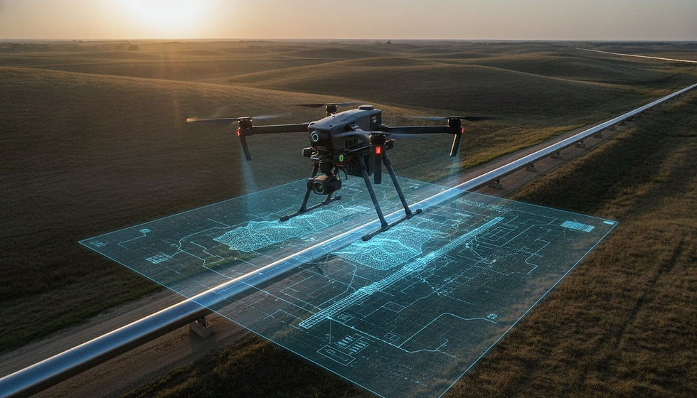
Technical Mechanics of RTK and PPK GNSS Correction
The integration of high-precision Global Navigation Satellite Systems (GNSS) within UAV platforms has fundamentally altered the Total Station vs RTK/PPK Drone Imagery dynamic by automating spatial correction. RTK systems synchronize the aircraft with a terrestrial base station or a Virtual Reference Station (VRS) via a continuous telemetry link. This active communication corrects satellite signal errors caused by ionospheric and tropospheric delays in real time. While efficient, this methodology remains susceptible to signal occlusion in dense infrastructure environments or urban canyons where physical obstructions disrupt the radio or cellular handshake. RTK is a mechanism for immediate centimeter-level spatial positioning.
Real-Time Kinematic (RTK) Connectivity Requirements
UAV operators deploying RTK must maintain a stable connection between the aircraft and the correction source. If the link drops for even a few seconds, the positional data reverts to standard GNSS accuracy, which may exceed 3 ft 3 in of error. This dependence on external infrastructure makes RTK ideal for open construction sites with accessible cellular networks but less reliable for expansive Utility and Pipeline Inspection Services where terrain often masks signal reception. The requirement for a persistent data link introduces a single point of failure that can compromise the spatial integrity of the entire dataset.
Post-Processed Kinematic (PPK) for Complex Environments
PPK provides a resilient alternative by logging raw GNSS data directly to the aircraft's internal storage without requiring a real-time connection. Corrections are applied during office-based processing by cross-referencing the flight logs with data from a base station. This approach eliminates the risk of telemetry failure, making it superior for remote forest canopy surveys or high-interference industrial zones. While RTK offers immediate field results, PPK ensures higher data integrity for the creation of high-fidelity digital twins. Both methodologies significantly reduce the operational cost of manual ground control point (GCP) placement, as high-precision onboard sensors can maintain absolute accuracy with 75% fewer physical markers compared to standard photogrammetry. This automation allows for the rapid capture of hundreds of acres without the logistical burden of manual staking across every 500 ft interval.
Strategic Deployment: Selecting the Optimal Survey Methodology
The strategic deployment of geospatial sensors is dictated by the intersection of project scale and environmental risk. While previous sections established the technical mechanics of GNSS correction, the enterprise value of Total Station vs RTK/PPK Drone Imagery is most visible during large-scale execution. As project areas exceed 50 acres, the efficiency of autonomous aerial systems becomes exponential. Traditional ground methods are constrained by the physical speed of technicians, whereas UAVs maintain a constant velocity regardless of terrain difficulty. This capability is vital in hazardous environments like erosion zones or high-voltage corridors where removing personnel from the field directly reduces liability and insurance overhead.
Topographic Complexity and Site Accessibility
Manual surveying faces significant degradation in efficiency when encountering even 6 in of vertical obstruction or dense undergrowth. Total stations require a clear line-of-sight between the instrument and the prism, a requirement that is frequently impossible in unrefined landscapes. UAVs bypass these terrestrial limitations, traversing 5 ft 11 in obstacles and complex verticalities without losing data fidelity. This autonomous approach provides a superior risk-adjusted cost profile for Erosion Monitoring Services, where unstable ground makes manual data collection precarious.
Volumetric Analysis and Large-Scale Infrastructure ROI
Volumetric calculations for stockpiles or earthworks reveal the most dramatic ROI disparity. A standard workflow involving 2 technicians for 8 hours can be replaced by 1 pilot for 45 minutes, delivering a dataset with 1,000,000 points per square foot via LiDAR rather than 100 points via manual sampling. Integrating these datasets into AI-driven geospatial analytics platforms allows for the automated extraction of asset conditions and predictive maintenance modeling. This shift toward high-density data capture ensures that infrastructure digital twins are built on comprehensive reality capture rather than interpolated estimations. For organizations seeking to optimize their field operations, our Construction Intel solutions provide the technical framework necessary for data-driven decision-making.
Advanced Data Transformation via AI-Driven Geospatial Analytics
The ultimate value of the Total Station vs RTK/PPK Drone Imagery comparison is realized during the post-processing phase, where raw spatial data is converted into actionable intelligence. While previous sections focused on the mechanics of acquisition, the transformation of these datasets determines the long-term ROI for enterprise infrastructure. High-fidelity digital twins serve as dynamic, autonomous representations of physical assets, providing a persistent record that exceeds the capabilities of static manual surveys. This shift from simple measurement to comprehensive scene intelligence allows for the strategic oversight of national asset portfolios with clinical precision.
Beyond Raw Imagery: Digital Twins and LiDAR Analysis
LiDAR data collection represents a critical technological leap over standard photogrammetry, particularly in environments with dense vegetation or complex structural verticality. Unlike passive sensors, LiDAR pulses penetrate through 6 in gaps in forest canopies to establish a true ground surface, which is essential for accurate terrain analysis in utility and pipeline corridors. This methodology is indispensable for capturing the intricate 3D geometry of complex pipeline networks where shadow and occlusion would otherwise compromise data integrity. AI transforms LiDAR point clouds into actionable asset intelligence by executing automated feature extraction and classifying discrete points into distinct infrastructure categories.
Implementation Protocols for Enterprise Infrastructure
Strategic industrial application requires the integration of geospatial data into existing GIS and Building Information Modeling (BIM) platforms. Establishing standardized workflows across national asset portfolios allows for predictive modeling, where AI identifies trends in erosion monitoring and facade health by analyzing temporal changes in the digital twin. Our Utility and Pipeline Inspection Services leverage these automated workflows to identify structural anomalies across vast corridors. Analyzing temporal deviations within the digital twin allows for the detection of millimeter-scale shifts before they threaten asset viability.
Explore our enterprise LiDAR and mapping solutions to optimize your geospatial data accuracy and infrastructure lifecycle management.
Optimizing Infrastructure Intelligence Through Advanced Geospatial Integration
Strategic selection within the Total Station vs RTK/PPK Drone Imagery framework is determined by the specific requirements for point-specific fidelity versus volumetric scene density. While Total Stations provide the sub-millimeter precision necessary for structural foundations, autonomous UAV platforms deliver the comprehensive spatial intelligence required for modern infrastructure management. The integration of high-density LiDAR data and AI-driven analytics facilitates the creation of dynamic digital twins that scale across expansive utility corridors. These systems effectively eliminate the logistical constraints and safety risks associated with manual ground-based surveying.
DroneWorksIQ provides national service coverage for enterprise clients seeking to modernize their geospatial workflows. Our technical expertise in LiDAR Data Collection and Analysis ensures that complex terrain and dense vegetation don't compromise data integrity. By leveraging AI-driven geospatial analytics, we transform raw sensor outputs into strategic insights that optimize the entire asset lifecycle. It's time to transition from static data points to a unified, high-performance digital environment. Contact DroneWorksIQ for Enterprise Aerial Intelligence Solutions and secure the technical precision your large-scale operations demand.
Frequently Asked Questions
Can a drone truly replace a Total Station for engineering-grade surveys?
UAV systems don't fully replace Total Stations for tasks requiring sub-millimeter point fidelity such as high-rise structural foundation placement or legal boundary certification. However, for topographical mapping and volumetric analysis, drones provide sufficient engineering-grade accuracy while reducing field time by 60-80%. Most sophisticated industrial workflows utilize a hybrid approach where total stations establish geodetic control and drones capture the comprehensive scene intelligence.
How much accuracy do I lose when switching from Total Station to RTK drone imagery?
Evaluating the shift in Total Station vs RTK/PPK Drone Imagery reveals a transition from 0.04 in to 0.12 in point accuracy to an absolute accuracy range of 0.4 in to 1.2 in. This trade-off in singular point precision is offset by a significant increase in data density. While a Total Station captures hundreds of selective points, a drone generates millions of data points to create a dense, photorealistic 3D model of the entire infrastructure asset.
What is the maximum vertical accuracy achievable with PPK drone mapping?
PPK drone mapping achieves a maximum vertical accuracy of approximately 0.4 in to 1.2 in when processed against high-quality base station data. This level of precision remains consistent even in complex terrain where terrestrial line-of-sight is obstructed. Reaching these tolerances requires a survey-grade camera sensor and rigorous post-processing protocols to eliminate GNSS signal noise encountered during the flight mission.
Is RTK or PPK better for pipeline inspections in remote areas with no cell service?
PPK is the superior methodology for pipeline inspections in remote environments lacking cellular or radio infrastructure. Because PPK logs raw GNSS data directly to the aircraft for subsequent office-based correction, it eliminates the risk of telemetry failure that disrupts RTK systems in signal-restricted zones. This ensures consistent data integrity across expansive utility corridors without the requirement for a persistent real-time connection.
How many ground control points (GCPs) are required when using an RTK-enabled drone?
Optimizing Total Station vs RTK/PPK Drone Imagery workflows typically requires only 1 to 3 ground control points for absolute coordinate verification and quality assurance. This represents a substantial reduction in manual GCP placement compared to standard photogrammetry missions. These points function primarily as checkpoints to validate the integrity of the onboard GNSS corrections and ensure the spatial model aligns perfectly with the established site datum.